

As Henry described it in his 1907 Autobiography, his father William Bradley owned one hundred acres, in the southeast corner of Wellington Township in Lorain County, Ohio where they relocated from Massachusetts in 1835. He wrote that they lived four miles from the village of Wellington which can be seen on the map below.
There are a total of three parcels in Wellington Township owned by Bradleys and a large number of parcels owned by Howks, the Dutch family that many Bradleys married into. In fact, the William Bradley farm had Howks on either side of it in Section One.
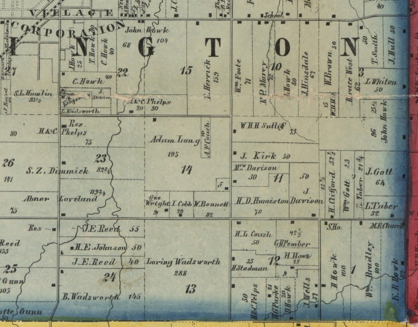
This 1857 map is in the Library of Congress collection and is available online.
